Future Mississauga · Ongoing · Updated October 2026
Building Future Mississauga
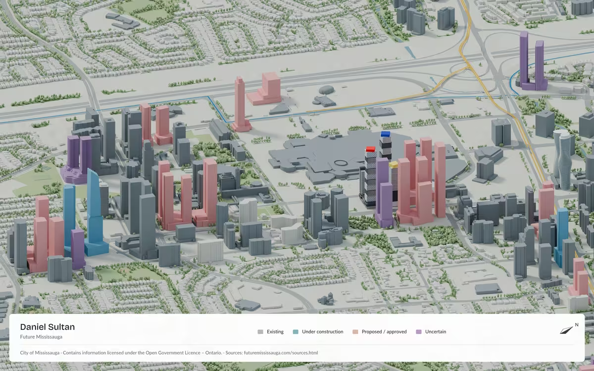
I wanted to see how Mississauga's new buildings and transit would fit together, beyond one development's render. Future Mississauga has grown into an interactive 3D atlas with neighbourhood views, existing-city comparisons and sources you can follow.
Shared with Mississauga by 905HUB.
905HUB featured my city visualisations in a collaborative Instagram post, crediting the visuals to @itsdanielsultan. It brought the work into a wider local conversation about how Mississauga's neighbourhoods could change.
More than a finished picture.
You can move around the city, compare existing context with proposed development, and see the Hurontario LRT, GO corridors and Transitway in their surroundings. The gallery, building studies and downloadable atlas offer different ways into the same project.
The atlas includes detailed local views of Churchill Meadows, Lisgar & Argentia, Meadowvale Village and East Credit & Creditview. Building studies cover homes, community buildings, heritage sites and local landmarks.
The gallery pairs neighbourhood pictures with downtown panoramas and a skyline film. A fixed viewpoint makes existing context, dated construction records and future scenarios easier to compare.
The interactive model, gallery pictures and individual studies carry their own dates and limits, so each view can be read in context.
Better references, better models.
At 1355 Winding Trail, the original mapped building was missing much of the visible exterior. References shared by Kleinfeldt Mychajlowycz Architects helped me add the tower, glazed front bays and lower green roofs. These published views use the same viewpoint so the changes are easy to compare.


The City footprint provides the starting scale and shape. Tower height, roof levels and unseen surfaces remain estimates. The ground shown here is a display base, not a survey.
The sources stay with the work.
I check the address, footprint, orientation and design against available drawings and photographs, then review how the building sits beside roads, ground and its neighbours. Local feedback helps me find missing buildings and outdated designs worth revisiting.
The public review records each project's sources, status and modelling limits. A proposed building is not necessarily approved, and approval does not mean construction has started. I keep those distinctions visible instead of treating the image as proof.
There is still more to check. Some forms are schematic, hidden details are estimated and parts of the city need better coverage. Model releases and gallery images are dated separately, so an older render is not presented as the latest model.